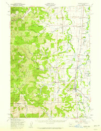
1957 Map of Monroe
USGS Topo · Published 1959About this map
The Southern Pacific rail line serves as a central spine through this Willamette Valley landscape, connecting a network of agricultural settlements and timbered foothills. Near the rail corridor, small communities like Alpine Junction, Bellfountain, and Monroe stand amidst a fertile plain defined by the Long Tom River and its meandering tributaries. The presence of the Willamette Grange and the Inavale School highlights the importance of civic and educational centers in the mid-century rural economy. To the west, the terrain rises sharply into the Siuslaw National Forest, where landmarks such as Flat Mtn and Buck Peak overlook the Corvallis Watershed Wild Animal Refuge. This map details the transition from the forested heights of the Oregon Coast Range to the marshy lowlands where Hulbert Lake and Harkens Lake reside.
Find a feature on this map
75 named features on this map. Tap any name to fly to it.
Don’t see what you’re looking for? This feature index may not catch every label — zoom into the map to look around manually.
Map Details
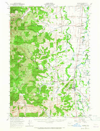
Editions of this 1957 Monroe Map
2 editions found
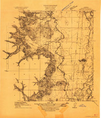
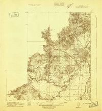
Other maps of this area

1909 · Harrisburg
USGS Topo · 1:31,680

1909 · Elmira
USGS Topo · 1:62,500

1910 · Eugene
USGS Topo · 1:62,500

1911 · Monroe
USGS Topo · 1:31,680
1911 · Inavale
USGS Topo · 1:31,680

1912 · Halsey
USGS Topo · 1:62,500
1913 · Philomath
USGS Topo · 1:31,680

1913 · Oakville
USGS Topo · 1:31,680

1916 · Albany
USGS Topo · 1:62,500

1921 · Corvallis
USGS Topo · 1:62,500