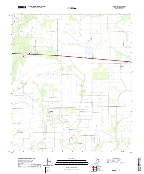
2022 Map of Monroe City
USGS Topo · Published 2022About this map
Monroe City and Hankamer anchor this Chambers County landscape, situated amidst a complex network of coastal water management and traditional family homesteads. The terrain is defined by the engineered Chambers-Liberty Counties Navigation District Canal and multiple branches of the Devers Canal, which interface with natural drainage like E Fork Double Bayou and Whites Bayou. For genealogists and local historians, the presence of specific family-named sites such as Broussard - White Cem, White Cem, and Rivon Cem provides critical points for tracing early residents. The southern portion of the map is dominated by the sprawling waterway of Oyster Bayou, while aviation history is represented by the XL Ranch Airport. This modern survey reflects the enduring pattern of East Texas coastal life, where irrigation infrastructure for rice farming or navigation shares the land with historic cemetery sites and small unincorporated communities.
Find a feature on this map
32 named features on this map. Tap any name to fly to it.
Don’t see what you’re looking for? This feature index may not catch every label — zoom into the map to look around manually.
Map Details
Editions of this 2022 Monroe City Map
This is the sole edition of this map. No revisions or reprints were ever made.
Other maps of this area

1942 · Anahuac
USGS Topo · 1:24,000

1943 · Whites Bayou
USGS Topo · 1:24,000

1943 · Sea Breeze
USGS Topo · 1:24,000

1943 · Stowell
USGS Topo · 1:24,000

1945 · Nolte
USGS Topo · 1:31,680

1945 · Sea Breeze
USGS Topo · 1:31,680

1950 · Houston
USGS Topo · 1:250,000

1956 · Houston
USGS Topo · 1:250,000
1961 · Anahuac
USGS Topo · 1:24,000
1961 · Monroe City
USGS Topo · 1:24,000