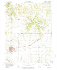
1959 Map of Monroe City
USGS Topo · Published 1960About this map
Monroe City serves as the focal point of this late 1950s survey, situated where the Chicago Burlington and Quincy and Wabash railroads intersect. The town's grid is well-defined, showing residential growth near North Park and South Park, along with civic landmarks like the High Sch and Washington Sch. Beyond the city limits, the landscape transitions into the agricultural and creek-fed terrain of Warren and Saline townships, where rural life is anchored by neighborhood centers such as Stone Sch and Mt Vernon Sch.
Find a feature on this map
32 named features on this map. Tap any name to fly to it.
Don’t see what you’re looking for? This feature index may not catch every label — zoom into the map to look around manually.
Map Details
Editions of this 1959 Monroe City Map
2 editions found
Other maps of this area

1903 · Palmyra
USGS Topo · 1:125,000

1948 · Quincy
USGS Topo · 1:250,000

1949 · Palmyra
USGS Topo · 1:24,000

1949 · Philadelphia
USGS Topo · 1:24,000

1950 · Palmyra
USGS Topo · 1:24,000

1950 · Philadelphia
USGS Topo · 1:24,000

1956 · Quincy
USGS Topo · 1:250,000
1958 · Rensselaer
USGS Topo · 1:24,000

1959 · Monroe City
USGS Topo · 1:24,000

1959 · Joanna
USGS Topo · 1:24,000