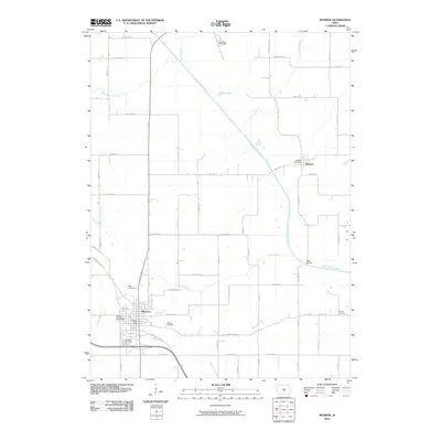
2010 Map of Monroe
USGS Topo · Published 2010About this map
Monroe and Reasnor anchor this Jasper County landscape, which is defined by the winding course of the South Skunk River as it moves southeast through the central Iowa countryside. The settlement pattern is characterized by a dense grid of rural roads and scattered homesteads, punctuated by the specialized facilities of the Riverview Honor Farm in the north and the Gateway Recreation Golf Course near Monroe.
Find a feature on this map
62 named features on this map. Tap any name to fly to it.
Don’t see what you’re looking for? This feature index may not catch every label — zoom into the map to look around manually.
Map Details
Editions of this 2010 Monroe Map
This is the sole edition of this map. No revisions or reprints were ever made.
Other maps of this area

1909 · Knoxville
USGS Topo · 1:62,500

1910 · Pella
USGS Topo · 1:62,500

1912 · Knoxville
USGS Topo · 1:62,500

1912 · Pella
USGS Topo · 1:62,500

1954 · Des Moines
USGS Topo · 1:250,000

1956 · Des Moines
USGS Topo · 1:250,000

1957 · Des Moines
USGS Topo · 1:250,000

1965 · Prairie City
USGS Topo · 1:24,000

1965 · Newton
USGS Topo · 1:24,000

1965 · Knoxville NW
USGS Topo · 1:24,000