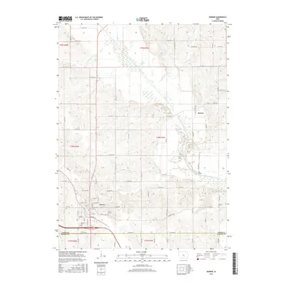
2015 Map of Monroe
USGS Topo · Published 2015About this map
Monroe sits at the intersection of local routes and legacy agricultural landscapes in southern Jasper County during the mid-2010s. The town's layout is meticulously detailed, showing the residential grid from Iowa St down to Sherman St, alongside local landmarks like the Monroe Cem and Gifford Cem. North of town, the terrain is defined by the winding course of the South Skunk River, which passes near the community of Reasnor and the crossing at Red Bridge. The map records a transition from the structured township grids of T78N and T79N into the more varied riparian landscape around Wire Lake and Warren Grove Cr. Further south, the boundary between Jasper Co and Marion Co is clearly demarcated, showing how family and local history are anchored to the section lines and rural avenues that crisscross the prairie.
Find a feature on this map
51 named features on this map. Tap any name to fly to it.
Don’t see what you’re looking for? This feature index may not catch every label — zoom into the map to look around manually.
Map Details
Editions of this 2015 Monroe Map
This is the sole edition of this map. No revisions or reprints were ever made.
Other maps of this area

1909 · Knoxville
USGS Topo · 1:62,500

1910 · Pella
USGS Topo · 1:62,500

1912 · Knoxville
USGS Topo · 1:62,500

1912 · Pella
USGS Topo · 1:62,500

1954 · Des Moines
USGS Topo · 1:250,000

1956 · Des Moines
USGS Topo · 1:250,000

1957 · Des Moines
USGS Topo · 1:250,000

1965 · Prairie City
USGS Topo · 1:24,000

1965 · Newton
USGS Topo · 1:24,000

1965 · Knoxville NW
USGS Topo · 1:24,000