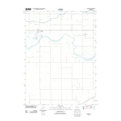
2011 Map of Monroe
USGS Topo · Published 2011About this map
The Loup River meanders across this Platte County landscape, defining the character of a region deeply tied to water management and agriculture. By 2011, the complex irrigation and drainage infrastructure is clearly visible through the Loup River Canal in the north and the strategic placement of the Lost Creek Ditch to the east. These engineering efforts support the surrounding rural grid, which is anchored by the village of Monroe. This settlement serves as a local hub for the surrounding township, featuring the Monroe Post Office as a central landmark along the primary east-west thoroughfare. To the southeast, the smaller community of Oconee sits near the river, while natural features like Lost Creek continue to shape the drainage patterns of the fertile plains. The map illustrates a modern era of precise land division, where traditional river geography intersects with extensive canal systems designed to sustain the Nebraska prairie.
Find a feature on this map
25 named features on this map. Tap any name to fly to it.
Don’t see what you’re looking for? This feature index may not catch every label — zoom into the map to look around manually.
Map Details
Editions of this 2011 Monroe Map
This is the sole edition of this map. No revisions or reprints were ever made.
Other maps of this area

1896 · Stromsburg
USGS Topo · 1:125,000

1899 · David City
USGS Topo · 1:125,000

1955 · Fremont
USGS Topo · 1:250,000

1957 · Fremont
USGS Topo · 1:250,000

1958 · Fremont
USGS Topo · 1:250,000

1958 · Genoa
USGS Topo · 1:24,000

1958 · Monroe
USGS Topo · 1:24,000

1958 · Duncan
USGS Topo · 1:24,000

1958 · Columbus SW
USGS Topo · 1:24,000

1958 · Silver Creek SE
USGS Topo · 1:24,000