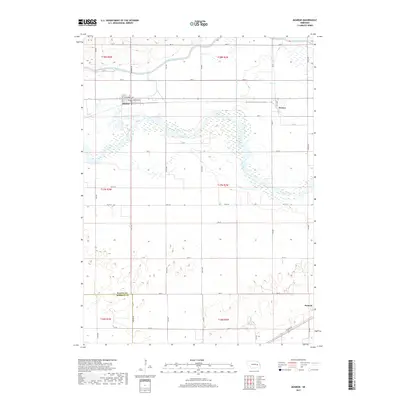
2017 Map of Monroe
USGS Topo · Published 2017About this map
The Loup River dominates this portion of the Platte River valley, carving a wide, braided path through central Nebraska. The settlement of Monroe serves as a local hub near the intersection of Columbus Ave and Gerrard Ave, situated just north of the river's main channel. This landscape is defined by its complex water management systems, including the Loup River Canal and the Lost Cr Ditch, which redirect water across the fertile plains to support the region's agricultural productivity. To the east, the community of Oconee sits near where Lost Cr approaches the primary river valley. The southern portion of the map transitions into the border between Platte and Merrick counties, where the terrain flattens toward the outskirts of Duncan. The grid of section lines and rural roads like Jackson Rd illustrates the enduring importance of the homestead-based land division that continues to shape the Nebraska interior.
Find a feature on this map
17 named features on this map. Tap any name to fly to it.
Don’t see what you’re looking for? This feature index may not catch every label — zoom into the map to look around manually.
Map Details
Editions of this 2017 Monroe Map
This is the sole edition of this map. No revisions or reprints were ever made.
Other maps of this area

1896 · Stromsburg
USGS Topo · 1:125,000

1899 · David City
USGS Topo · 1:125,000

1955 · Fremont
USGS Topo · 1:250,000

1957 · Fremont
USGS Topo · 1:250,000

1958 · Fremont
USGS Topo · 1:250,000

1958 · Genoa
USGS Topo · 1:24,000

1958 · Monroe
USGS Topo · 1:24,000

1958 · Duncan
USGS Topo · 1:24,000

1958 · Columbus SW
USGS Topo · 1:24,000

1958 · Silver Creek SE
USGS Topo · 1:24,000