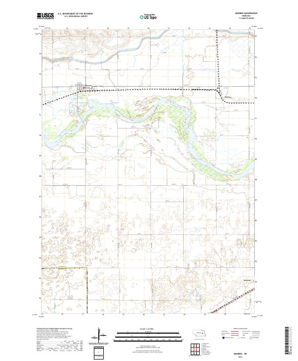
2021 Map of Monroe
USGS Topo · Published 2021About this map
Loup River and its intricate braided channels dominate this section of the Nebraska landscape, flowing through a region where agriculture and water management are deeply entwined. The Loup River Canal parallels the river to the north, highlighting the extensive irrigation infrastructure that supports the surrounding farmstead grid. The village of Monroe serves as a primary local hub, established where Columbus Ave and Railroad Ave converge along the rail corridor. Further east, the smaller community of Oconee sits near the junction of Lost Cr and its associated Lost Cr Ditch. This 2021 survey also documents the county boundary between Platte Co and Merrick Co in the southern reaches near Duncan, where Jackson Rd cuts across the lowlands of the river valley.
Find a feature on this map
31 named features on this map. Tap any name to fly to it.
Don’t see what you’re looking for? This feature index may not catch every label — zoom into the map to look around manually.
Map Details
Editions of this 2021 Monroe Map
This is the sole edition of this map. No revisions or reprints were ever made.
Other maps of this area

1896 · Stromsburg
USGS Topo · 1:125,000

1899 · David City
USGS Topo · 1:125,000

1955 · Fremont
USGS Topo · 1:250,000

1957 · Fremont
USGS Topo · 1:250,000

1958 · Fremont
USGS Topo · 1:250,000

1958 · Genoa
USGS Topo · 1:24,000

1958 · Monroe
USGS Topo · 1:24,000

1958 · Duncan
USGS Topo · 1:24,000

1958 · Columbus SW
USGS Topo · 1:24,000

1958 · Silver Creek SE
USGS Topo · 1:24,000