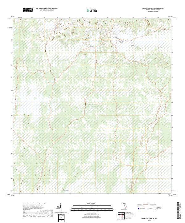
2024 Map of Monroe Station NE
USGS Topo · Published 2024About this map
Big Cypress National Preserve encompasses the vast majority of this landscape, characterized by a complex network of wetlands and subtropical prairies. The terrain is defined by slow-moving water channels known as strands, including Monroe Strand and Barnes Strand, which dictate the movement of both water and travelers through the region. Sparse human infrastructure is limited to specialized facilities like the Romor Ranch Airport and an extensive network of primitive paths.
Find a feature on this map
22 named features on this map. Tap any name to fly to it.
Don’t see what you’re looking for? This feature index may not catch every label — zoom into the map to look around manually.
Map Details
Editions of this 2024 Monroe Station NE Map
This is the sole edition of this map. No revisions or reprints were ever made.
Other maps of this area

1956 · Miami
USGS Topo · 1:250,000

1956 · West Palm Beach
USGS Topo · 1:250,000

1957 · West Palm Beach
USGS Topo · 1:250,000

1958 · West Palm Beach
USGS Topo · 1:250,000

1958 · Miami
USGS Topo · 1:250,000

1972 · Monroe Station NE
USGS Topo · 1:24,000

1972 · Burns Lake
USGS Topo · 1:24,000

1973 · Gator Hook Swamp
USGS Topo · 1:24,000

1973 · Fiftymile Bend
USGS Topo · 1:24,000

1973 · North Of Fiftymile Bend
USGS Topo · 1:24,000