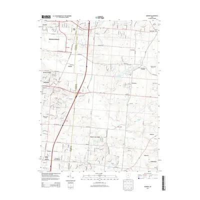
2013 Map of Monroe
USGS Topo · Published 2013About this map
Monroe and Middletown anchor this landscape along the border of Butler and Warren Counties, where suburban growth meets the agricultural history of southwestern Ohio. The map detail highlights several historic burial grounds, including the Mound Cem and the Otterbein Shaker Cem, which point to the region's early communal and religious roots. Residential developments like Evergreen Farm Estates, Brittany Heights, and Shadow Lake Village illustrate the mid-to-late 20th-century transition of former farmland into residential neighborhoods. This shift is balanced by preserved water features and recreation areas such as Armco Park Lake and Shroder Lake, while numerous small drainages like Millers Cr and Shaker Cr continue to define the natural topography of the watershed.
Find a feature on this map
168 named features on this map. Tap any name to fly to it.
Don’t see what you’re looking for? This feature index may not catch every label — zoom into the map to look around manually.
Map Details
Editions of this 2013 Monroe Map
This is the sole edition of this map. No revisions or reprints were ever made.
Other maps of this area

1904 · Mason
USGS Topo · 1:62,500

1906 · Mason
USGS Topo · 1:62,500

1908 · Miamisburg
USGS Topo · 1:62,500

1913 · Waynesville
USGS Topo · 1:62,500

1914 · Morrow
USGS Topo · 1:62,500

1915 · Waynesville
USGS Topo · 1:62,500

1916 · Morrow
USGS Topo · 1:62,500

1951 · Franklin
USGS Topo · 1:24,000

1953 · Cincinnati
USGS Topo · 1:250,000

1955 · Monroe
USGS Topo · 1:24,000