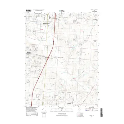
2016 Map of Monroe
USGS Topo · Published 2016About this map
The corridor between Middletown and Mason is defined by a dense network of suburban development and historical crossroads as seen in the mid-2010s. Along the Butler Co and Warren Co line, the landscape transitions from industrial and commercial centers to the sprawling residential communities of Monroe and Bethany. The map captures numerous small burial sites that hint at the region's earlier agricultural and religious foundations, including the Mound Cem and the Otterbein-Shaker Cem near the Otterbein community.
Find a feature on this map
184 named features on this map. Tap any name to fly to it.
Don’t see what you’re looking for? This feature index may not catch every label — zoom into the map to look around manually.
Map Details
Editions of this 2016 Monroe Map
This is the sole edition of this map. No revisions or reprints were ever made.
Other maps of this area

1904 · Mason
USGS Topo · 1:62,500

1906 · Mason
USGS Topo · 1:62,500

1908 · Miamisburg
USGS Topo · 1:62,500

1913 · Waynesville
USGS Topo · 1:62,500

1914 · Morrow
USGS Topo · 1:62,500

1915 · Waynesville
USGS Topo · 1:62,500

1916 · Morrow
USGS Topo · 1:62,500

1951 · Franklin
USGS Topo · 1:24,000

1953 · Cincinnati
USGS Topo · 1:250,000

1955 · Monroe
USGS Topo · 1:24,000