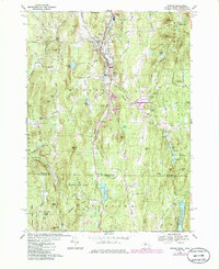
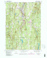
1967 Map of Monson
USGS Topo · Published 1985About this map
The Central Vermont railroad corridor defines the central valley of this 1967 survey, threading through the industrial and residential heart of Monson and its satellite settlements, North Monson and South Monson. The landscape is a mix of steep wooded ridges like West Hill and Pinnacle Peak and managed water resources, including the Conant Brook Reservoir and the Staffordville Reservoir near Four Corners. Genealogists will find significant local history in the cluster of burial grounds including Hillside Cem, Bethany Cem, and the upland Peaked Mtn Cem. The southern portion of the map crosses the Massachusetts-Connecticut state line into the Shenipsit State Forest, where terrain features like Diamond Ledge and Tray Hollow dominate the topography. This edition also highlights the early development of infrastructure such as the South Monson Substation and various pipelines traversing the rugged Brimfield State Forest.
Find a feature on this map
92 named features on this map. Tap any name to fly to it.
Don’t see what you’re looking for? This feature index may not catch every label — zoom into the map to look around manually.
Map Details
Editions of this 1967 Monson Map
5 editions found
Other maps of this area

1887 · Brookfield
USGS Topo · 1:62,500

1887 · Palmer
USGS Topo · 1:62,500

1889 · Palmer
USGS Topo · 1:62,500

1890 · Brookfield
USGS Topo · 1:62,500

1892 · Woodstock
USGS Topo · 1:62,500

1892 · Tolland
USGS Topo · 1:62,500

1893 · Palmer
USGS Topo · 1:62,500

1893 · Brookfield
USGS Topo · 1:62,500

1908 · Ware
USGS Topo · 1:125,000

1915 · Brookfield
USGS Topo · 1:62,500