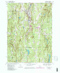
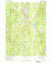
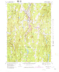
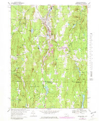
1967 Map of Monson
USGS Topo · Published 1985About this map
Chicopee Brook winds through the heart of the valley, anchoring a series of industrial and agricultural settlements along the Central Vermont line. During the late 1960s, the area around Monson and South Monson maintained a balance between its manufacturing roots and its upland forest character. The landscape is defined by prominent high points like Peaked Mtn and Mount Hitchcock, while the northern portion of the quadrangle shows the development of the Conant Brook Reservoir for flood control. Genealogists can find several historic burial grounds, including Hillside Cem and Bethany Cem, while the Old Railroad Grade north of South Nichols Mtn offers a physical trace of earlier transportation routes that once served the local quarries and textile mills.
Find a feature on this map
112 named features on this map. Tap any name to fly to it.
Don’t see what you’re looking for? This feature index may not catch every label — zoom into the map to look around manually.
Map Details
Editions of this 1967 Monson Map
5 editions found

Other maps of this area

1887 · Brookfield
USGS Topo · 1:62,500

1887 · Palmer
USGS Topo · 1:62,500

1889 · Palmer
USGS Topo · 1:62,500

1890 · Brookfield
USGS Topo · 1:62,500

1892 · Woodstock
USGS Topo · 1:62,500

1892 · Tolland
USGS Topo · 1:62,500

1893 · Palmer
USGS Topo · 1:62,500

1893 · Brookfield
USGS Topo · 1:62,500

1908 · Ware
USGS Topo · 1:125,000

1915 · Brookfield
USGS Topo · 1:62,500