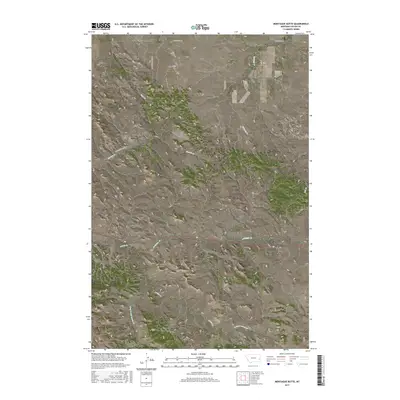
2017 Map of Montague Butte
USGS Topo · Published 2017About this map
Montague Butte stands as a prominent landmark in this expanse of Eastern Montana, part of a landscape defined by isolated peaks and seasonal watercourses. The drainage patterns of the region are shaped by several major creeks, including Locate Cr and Archdale Cr, which cut through the high plains. Historically, the area is crossed by several distinctive routes such as the Terry Cut Across Rd, suggesting its role as a corridor for travel between early regional outposts. Elevations vary across the sheet from the heights of Henry Woods Mtn to the lower reaches of Norton Cr. The map details a remote section of Custer and Fallon Counties where the land remains largely open, marked by landmarks like Rattlesnake Butte and Twin Buttes that served as navigational points for generations.
Find a feature on this map
21 named features on this map. Tap any name to fly to it.
Don’t see what you’re looking for? This feature index may not catch every label — zoom into the map to look around manually.
Map Details
Editions of this 2017 Montague Butte Map
This is the sole edition of this map. No revisions or reprints were ever made.
Other maps of this area

1953 · Miles City
USGS Topo · 1:250,000

1957 · Miles City
USGS Topo · 1:250,000

1958 · Miles City
USGS Topo · 1:250,000

1969 · Little Whitney Creek
USGS Topo · 1:24,000

1969 · Knowlton
USGS Topo · 1:24,000

1969 · Hogan Creek
USGS Topo · 1:24,000

1969 · Montague Butte
USGS Topo · 1:24,000

1969 · Flat Top Butte SW
USGS Topo · 1:24,000
1969 · Red Knob
USGS Topo · 1:24,000

1980 · Terry
USGS Topo · 1:100,000