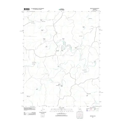
2011 Map of Montauk
USGS Topo · Published 2011About this map
Montauk State Park anchors this portion of the Ozark Highlands, where the headwaters of the Current River begin at Montauk Springs. The landscape is defined by an intricate network of hollows, including Hoosier Hollow, Wolf Hollow, and Dead Horse Hollow, which drain into the principal waterways of Pigeon Creek and North Ashley Creek. The small settlement of Montauk sits at the junction of local roads, serving as a gateway to the river and the nearby Baptist River Access.
Find a feature on this map
57 named features on this map. Tap any name to fly to it.
Don’t see what you’re looking for? This feature index may not catch every label — zoom into the map to look around manually.
Map Details
Editions of this 2011 Montauk Map
This is the sole edition of this map. No revisions or reprints were ever made.
Other maps of this area

1932 · Cedar Grove
USGS Topo · 1:48,000

1937 · Edgar Springs
USGS Topo · 1:48,000

1941 · Salem
USGS Topo · 1:62,500

1945 · Salem
USGS Topo · 1:62,500

1945 · Edgar Springs
USGS Topo · 1:62,500

1949 · Rolla
USGS Topo · 1:250,000

1951 · Montauk
USGS Topo · 1:24,000

1951 · Licking
USGS Topo · 1:24,000

1951 · Cedargrove
USGS Topo · 1:24,000

1951 · Raymondville
USGS Topo · 1:24,000