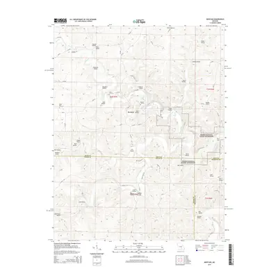
2015 Map of Montauk
USGS Topo · Published 2015About this map
Montauk Springs serves as a central hydrological feature for this portion of the Ozarks, feeding the cold waters of the Current River as it flows south through the Ozark National Scenic Riverways. The landscape is defined by the Salem Upland and a dense network of hollows, including Hoosier Hollow and Crabtree Hollow, which illustrate the region's complex drainage into Pigeon Cr and Ashley Cr. This 2015 survey reveals a rural Missouri landscape where small settlements like Montauk and Ashley Creek are anchored by family-named landmarks. Several historic burial grounds, such as Paterson Cemetery, Cole Cemetery, and Mount Olive Cemetery, are scattered across the hills, offering critical locations for genealogical research. The map also identifies local landmarks like the Tan Vat Hole and The S Turn, reflecting the intimate geographic nomenclature used by the local community.
Find a feature on this map
86 named features on this map. Tap any name to fly to it.
Don’t see what you’re looking for? This feature index may not catch every label — zoom into the map to look around manually.
Map Details
Editions of this 2015 Montauk Map
This is the sole edition of this map. No revisions or reprints were ever made.
Other maps of this area

1932 · Cedar Grove
USGS Topo · 1:48,000

1937 · Edgar Springs
USGS Topo · 1:48,000

1941 · Salem
USGS Topo · 1:62,500

1945 · Salem
USGS Topo · 1:62,500

1945 · Edgar Springs
USGS Topo · 1:62,500

1949 · Rolla
USGS Topo · 1:250,000

1951 · Montauk
USGS Topo · 1:24,000

1951 · Licking
USGS Topo · 1:24,000

1951 · Cedargrove
USGS Topo · 1:24,000

1951 · Raymondville
USGS Topo · 1:24,000