
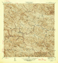
1946 Map of Monte Guilarte
USGS Topo · Published 1946About this map
Monte Guilarte rises as a central landmark in this mid-century survey of the Cordillera Central, where the interior highlands of Puerto Rico are defined by a dense network of family-owned agricultural estates. The landscape is characterized by numerous haciendas, such as Hacienda Juanita, Hacienda Indiera, and Hacienda Santa Maria, illustrating the plantation-based economy of the 1940s. These estates are connected by narrow roads like 8 and 16, which wind through steep terrain marked by peaks like Cerro Avispa and Cerro Medina.
Find a feature on this map
148 named features on this map. Tap any name to fly to it.
Don’t see what you’re looking for? This feature index may not catch every label — zoom into the map to look around manually.
Map Details
Editions of this 1946 Monte Guilarte Map
3 editions found
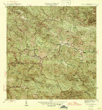
Other maps of this area

1937 · Sabana Grande
USGS Topo · 1:25,000

1938 · San Sebastian
USGS Topo · 1:20,000

1941 · San Sebastian
USGS Topo · 1:30,000

1941 · Sabana Grande
USGS Topo · 1:30,000

1946 · Maricao
USGS Topo · 1:30,000

1946 · Utuado
USGS Topo · 1:30,000

1946 · Bayaney
USGS Topo · 1:30,000

1946 · Yauco
USGS Topo · 1:30,000

1946 · Penuelas
USGS Topo · 1:30,000

1946 · Adjuntas
USGS Topo · 1:30,000
Featured Places
- Sector Los Pagán, Adjuntas
- Sector Palo Seco, Adjuntas
- Sector Jiménez Santiago, Adjuntas
- Sector Titulo Quinto, Adjuntas
- Sector Lombrices, Adjuntas