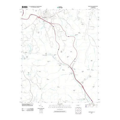
2010 Map of Monteagle
USGS Topo · Published 2010About this map
Monteagle sits atop the Cumberland Plateau, serving as a focal point for this 2010 survey of the surrounding mountain landscape. The geography is defined by dramatic elevation changes where the plateau breaks into numerous coves and points, including Bridal Veil Cove and Gaines Cove. Water features are abundant throughout the terrain, from the Jumpoff Falls and Monteagle Falls to man-made landmarks like Tom McBee Lake and Laurel Lake.
Find a feature on this map
105 named features on this map. Tap any name to fly to it.
Don’t see what you’re looking for? This feature index may not catch every label — zoom into the map to look around manually.
Map Details
Editions of this 2010 Monteagle Map
This is the sole edition of this map. No revisions or reprints were ever made.
Other maps of this area

1895 · Sewanee
USGS Topo · 1:125,000

1936 · Sewanee
USGS Topo · 1:24,000

1936 · Alto
USGS Topo · 1:24,000

1936 · Orme
USGS Topo · 1:24,000

1936 · Sinking Cove
USGS Topo · 1:24,000

1936 · Burrow Cove
USGS Topo · 1:24,000

1936 · Tracy City
USGS Topo · 1:24,000

1936 · Monteagle
USGS Topo · 1:24,000

1936 · White City
USGS Topo · 1:24,000
1936 · South Pittsburg
USGS Topo · 1:24,000