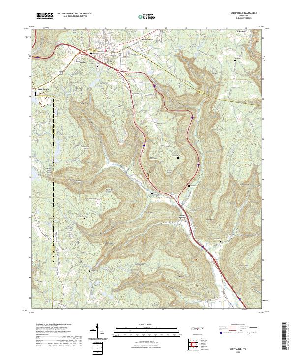
2022 Map of Monteagle
USGS Topo · Published 2022About this map
The Cumberland Plateau dominates this landscape where the borders of Grundy, Marion, and Franklin counties converge. Modern transportation corridors like the Dixie Lee Hwy and the interstate cut across the high ground of Monteagle, while a complex network of deep coves and ridges falls away to the south and east. These topographical depressions, such as Drip Spring Cove, Trussell Cove, and Gaines Cove, have historically dictated the placement of small settlements and family holdings.
Find a feature on this map
134 named features on this map. Tap any name to fly to it.
Don’t see what you’re looking for? This feature index may not catch every label — zoom into the map to look around manually.
Map Details
Editions of this 2022 Monteagle Map
This is the sole edition of this map. No revisions or reprints were ever made.
Other maps of this area

1895 · Sewanee
USGS Topo · 1:125,000

1936 · Sewanee
USGS Topo · 1:24,000

1936 · Alto
USGS Topo · 1:24,000

1936 · Orme
USGS Topo · 1:24,000

1936 · Sinking Cove
USGS Topo · 1:24,000

1936 · Burrow Cove
USGS Topo · 1:24,000

1936 · Tracy City
USGS Topo · 1:24,000

1936 · Monteagle
USGS Topo · 1:24,000

1936 · White City
USGS Topo · 1:24,000
1936 · South Pittsburg
USGS Topo · 1:24,000