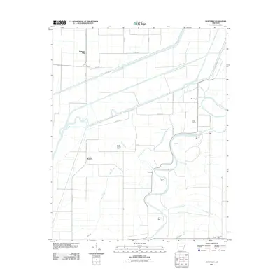
2011 Map of Monterey
USGS Topo · Published 2011About this map
Saint Francis River meanders through this portion of eastern Arkansas, defining a landscape of complex waterways and alluvial bars. The settlement of Fortune and the nearby Fortune Bar sit along a prominent bend in the river, while the tiny community of Twist is situated to the southeast, complete with the Twist Post Office. The area is marked by a network of drainage and overflow features, including Wolf Slough, Fortune Slough, and Big Beaver Slough, which weave between agricultural fields and forested patches.
Find a feature on this map
48 named features on this map. Tap any name to fly to it.
Don’t see what you’re looking for? This feature index may not catch every label — zoom into the map to look around manually.
Map Details
Editions of this 2011 Monterey Map
This is the sole edition of this map. No revisions or reprints were ever made.
Other maps of this area

1940 · Deckerville
USGS Topo · 1:62,500

1940 · Princedale
USGS Topo · 1:62,500

1940 · Dee
USGS Topo · 1:62,500

1941 · Marked Tree
USGS Topo · 1:62,500

1953 · Memphis
USGS Topo · 1:250,000

1956 · Marked Tree
USGS Topo · 1:62,500

1956 · Memphis
USGS Topo · 1:250,000

1956 · Princedale
USGS Topo · 1:62,500

1957 · Deckerville
USGS Topo · 1:62,500

1958 · Dee
USGS Topo · 1:62,500