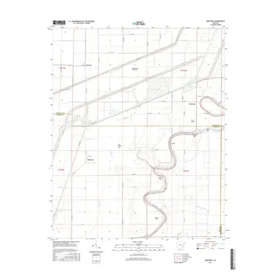
2017 Map of Monterey
USGS Topo · Published 2017About this map
The Saint Francis River winds through a complex landscape of alluvial wetlands and agricultural tracts along the border of Cross and Poinsett counties. This terrain is defined by its hydraulic management and natural overflow features, most notably the expansive Oak Donnick Floodway and the channelized Ditch 37 Rd. The settlement of Monterey and the community at Stewart sit amidst a network of sloughs and bars, reflecting the historical importance of river navigation and drainage in this corner of Arkansas. Numerous river features such as Fortune Bar, Wheeler Bar, and Lee Bar illustrate the shifting nature of the river channel over time. Further east, Sunk Timber Lake and Hog Slough point to the remnant swamp ecology that once dominated this region before modern land reclamation efforts transformed the bottomlands.
Find a feature on this map
50 named features on this map. Tap any name to fly to it.
Don’t see what you’re looking for? This feature index may not catch every label — zoom into the map to look around manually.
Map Details
Editions of this 2017 Monterey Map
This is the sole edition of this map. No revisions or reprints were ever made.
Other maps of this area

1940 · Deckerville
USGS Topo · 1:62,500

1940 · Princedale
USGS Topo · 1:62,500

1940 · Dee
USGS Topo · 1:62,500

1941 · Marked Tree
USGS Topo · 1:62,500

1953 · Memphis
USGS Topo · 1:250,000

1956 · Marked Tree
USGS Topo · 1:62,500

1956 · Memphis
USGS Topo · 1:250,000

1956 · Princedale
USGS Topo · 1:62,500

1957 · Deckerville
USGS Topo · 1:62,500

1958 · Dee
USGS Topo · 1:62,500