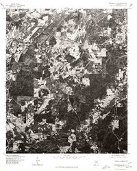
1975 Map of Montevallo SE
USGS Topo · Published 1977About this map
Montevallo and Calera anchor the northern reaches of this mid-1970s orthophotoquad, which emphasizes the industrial and agricultural interface of central Alabama. Produced in cooperation with the Soil Conservation Service, the imagery reveals the heavy footprint of large-scale quarrying and industrial operations northeast of Calera, where massive excavations and complex processing facilities dominate the terrain. Outside of these industrial hubs, the landscape is defined by a dense mosaic of forested tracts and cleared agricultural parcels, showing the distinct property lines and field patterns characteristic of the region's land use during this era. The orthophoto format provides a clear view of the transportation network connecting these two settlements, including the primary road corridors that facilitated the movement of materials from local quarries to the rail and highway systems.
Find a feature on this map
2 named features on this map. Tap any name to fly to it.
Don’t see what you’re looking for? This feature index may not catch every label — zoom into the map to look around manually.
Map Details
Editions of this 1975 Montevallo SE Map
This is the sole edition of this map. No revisions or reprints were ever made.
Other maps of this area

1890 · Bessemer
USGS Topo · 1:125,000

1891 · Clanton
USGS Topo · 1:125,000

1892 · Bessemer
USGS Topo · 1:125,000

1909 · Columbiana
USGS Topo · 1:62,500

1910 · Montevallo
USGS Topo · 1:62,500

1911 · Columbiana
USGS Topo · 1:62,500

1953 · Montgomery
USGS Topo · 1:250,000

1953 · Birmingham
USGS Topo · 1:250,000

1956 · Birmingham
USGS Topo · 1:250,000

1956 · Montgomery
USGS Topo · 1:250,000