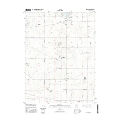
2016 Map of Montezuma
USGS Topo · Published 2016About this map
Montezuma Bay and the southern reaches of Grand Lake anchor this agricultural landscape in Mercer County, where the grid of rural roads connects several tight-knit communities. The area is defined by a high density of religious and commemorative sites, particularly Roman Catholic landmarks such as Saint Aloysious Catholic Cem, Saint Sebastian Catholic Cem, and Saint Rose Catholic Cem. These sites, along with the settlements of Carthagena, Cassella, and Saint Rosa, reflect the deep heritage of the Land of the Cross-Tipped Churches region. The terrain is drained by a network of waterways including Beaver Cr and Prairie Cr, while Lakefield Airport provides a modern navigational point near the village of Montezuma. Further south, the map reaches the Wabash River and the rural crossroads of Cranberry Prairie, illustrating the persistent agrarian character of western Ohio.
Find a feature on this map
76 named features on this map. Tap any name to fly to it.
Don’t see what you’re looking for? This feature index may not catch every label — zoom into the map to look around manually.
Map Details
Editions of this 2016 Montezuma Map
This is the sole edition of this map. No revisions or reprints were ever made.
Other maps of this area

1908 · St. Henry
USGS Topo · 1:62,500

1909 · Loramie
USGS Topo · 1:62,500

1911 · Loramie
USGS Topo · 1:62,500

1911 · Spencerville
USGS Topo · 1:62,500

1914 · Celina
USGS Topo · 1:62,500

1944 · Loramie
USGS Topo · 1:62,500

1944 · Celina
USGS Topo · 1:62,500

1944 · Spencerville
USGS Topo · 1:62,500

1953 · Muncie
USGS Topo · 1:250,000

1956 · Muncie
USGS Topo · 1:250,000