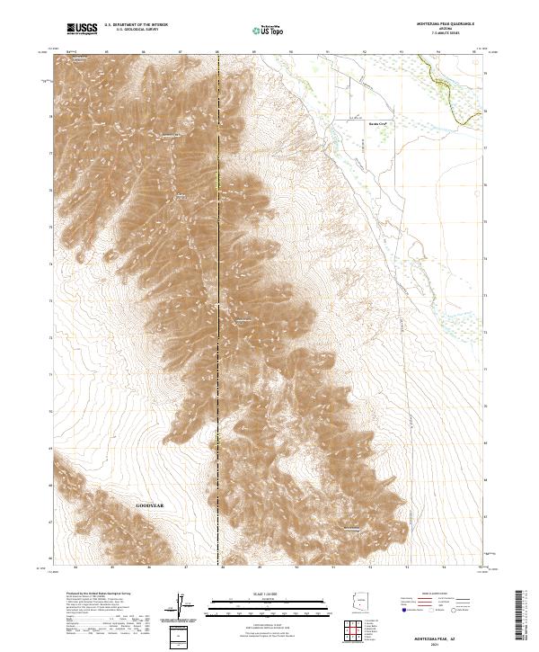
2021 Map of Montezuma Peak
USGS Topo · Published 2021About this map
The Sierra Estrella range dominates this landscape at the boundary of Maricopa and Pinal counties, defining a sharp contrast between the high peaks and the irrigated lowlands to the east. The rugged terrain includes notable landmarks such as Montezuma Peak, Butterfly Mtn, and the distinctive Montezuma Sleeping formation. In the flatter desert plains, the settlement of Santa Cruz and the southern edge of Goodyear sit among a complex network of ephemeral waterways and irrigation infrastructure, including the Santa Cruz Wash and Vekol Wash. Historical agricultural water management is evident through features like the Santa Cruz Ditch and Hoover Ditch, while rural connectivity is maintained by local routes such as Komatke Rd and Voah Shun Rd. The presence of the Gila River in the northern reaches further underscores the vital role of water in this arid region.
Find a feature on this map
22 named features on this map. Tap any name to fly to it.
Don’t see what you’re looking for? This feature index may not catch every label — zoom into the map to look around manually.
Map Details
Editions of this 2021 Montezuma Peak Map
This is the sole edition of this map. No revisions or reprints were ever made.
Other maps of this area

1912 · Phoenix
USGS Topo · 1:62,500

1913 · Maricopa
USGS Topo · 1:62,500

1914 · Phoenix
USGS Topo · 1:62,500

1915 · Maricopa
USGS Topo · 1:62,500

1946 · Avondale
USGS Topo · 1:62,500

1948 · Cashion
USGS Topo · 1:62,500

1951 · Mobile
USGS Topo · 1:62,500

1952 · Maricopa
USGS Topo · 1:24,000

1952 · Lone Butte
USGS Topo · 1:24,000

1952 · Laveen
USGS Topo · 1:24,000