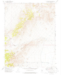
1970 Map of Montezuma Peak SW
USGS Topo · Published 1978About this map
The Montezuma Range and Palmetto Mountains dominate this high-desert landscape in Esmeralda County, providing a glimpse into the region's mineral-driven history and water-resource management around 1970. Evidence of resource extraction is found at a prospect located on the eastern slopes, while the presence of an Aqueduct and several Water Tanks in the southern flats indicates the critical infrastructure required to support life and industry in this arid climate. Vital natural water sources like Railroad Spring and Cedar Spring are mapped among the foothills, connected by a network of Jeep Trails and a Jeep Tr. The topographic relief is defined by the natural corridor at Railroad Pass, a strategic crossing point between the two mountain systems.
Find a feature on this map
10 named features on this map. Tap any name to fly to it.
Don’t see what you’re looking for? This feature index may not catch every label — zoom into the map to look around manually.
Map Details
Editions of this 1970 Montezuma Peak SW Map
2 editions found
Other maps of this area

1898 · Silver Peak
USGS Topo · 1:125,000

1900 · Silver Peak
USGS Topo · 1:125,000

1908 · Lida
USGS Topo · 1:250,000

1913 · Lida
USGS Topo · 1:250,000

1945 · Goldfield
USGS Topo · 1:125,000

1954 · Goldfield
USGS Topo · 1:250,000

1955 · Goldfield
USGS Topo · 1:250,000

1957 · Magruder Mtn
USGS Topo · 1:62,500

1958 · Goldfield
USGS Topo · 1:250,000

1962 · Goldfield
USGS Topo · 1:250,000