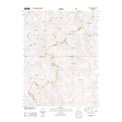
2013 Map of Montezuma
USGS Topo · Published 2013About this map
The town of Montezuma sits high in the Colorado Rockies, surrounded by peaks that reach over 13,000 feet. This 2013 survey details a landscape where historic mining and modern preservation converge, documented by the presence of the Bullion Mine and the Montezuma Cem west of the settlement. The Continental Divide National Scenic Trail NST snakes along the ridges, crossing high points like Santa Fe Peak and Argentine Peak. A significant engineering feature, the Harold D Roberts Tunnel, is shown cutting deep beneath the mountains, carrying water under the divide. This map spans the boundaries of the Arapaho, White River, and Pike National Forest, illustrating the complex drainage systems of the Snake River and Geneva Creek that originate in these alpine basins.
Find a feature on this map
77 named features on this map. Tap any name to fly to it.
Don’t see what you’re looking for? This feature index may not catch every label — zoom into the map to look around manually.
Map Details
Editions of this 2013 Montezuma Map
This is the sole edition of this map. No revisions or reprints were ever made.
Other maps of this area

1903 · Georgetown
USGS Topo · 1:62,500

1905 · Georgetown
USGS Topo · 1:62,500

1924 · Montezuma
USGS Topo · 1:62,500

1926 · Montezuma
USGS Topo · 1:62,500

1933 · Montezuma
USGS Topo · 1:62,500

1937 · Como
USGS Topo · 1:62,500

1945 · Mount Logan
USGS Topo · 1:24,000

1948 · Mount Logan
USGS Topo · 1:24,000

1953 · Denver
USGS Topo · 1:250,000

1957 · Denver
USGS Topo · 1:250,000