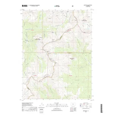
2019 Map of Montezuma
USGS Topo · Published 2019About this map
The town of Montezuma serves as the focal point for this high-altitude landscape where the Continental Divide separates the White River National Forest, Arapaho National Forest, and Pike National Forest. The map documents a complex mining and transit history, evidenced by the Peruvian Mine and numerous high-mountain roads such as the Radical Mine Road and Chatauqua Mine Road. These steep routes lead to prominent summits like Argentine Peak, Santa Fe Peak, and Teller Mtn.
Find a feature on this map
76 named features on this map. Tap any name to fly to it.
Don’t see what you’re looking for? This feature index may not catch every label — zoom into the map to look around manually.
Map Details
Editions of this 2019 Montezuma Map
This is the sole edition of this map. No revisions or reprints were ever made.
Other maps of this area

1903 · Georgetown
USGS Topo · 1:62,500

1905 · Georgetown
USGS Topo · 1:62,500

1924 · Montezuma
USGS Topo · 1:62,500

1926 · Montezuma
USGS Topo · 1:62,500

1933 · Montezuma
USGS Topo · 1:62,500

1937 · Como
USGS Topo · 1:62,500

1945 · Mount Logan
USGS Topo · 1:24,000

1948 · Mount Logan
USGS Topo · 1:24,000

1953 · Denver
USGS Topo · 1:250,000

1957 · Denver
USGS Topo · 1:250,000