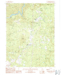
1990 Map of Montgomery Creek
USGS Topo · Published 1990About this map
Montgomery Creek Rancheria and the settlement of Montgomery Creek occupy a landscape defined by the steep drainage systems of the Shasta National Forest. Mapping from the late 1980s reveals a complex network of water management and industrial infrastructure, including the Carney Ditch and the Cedar Creek Powerhouse, which draws from a Powerhouse Intake on Cedar Creek. The terrain is marked by prominent elevations like Hogback Mountain and Round Mountain, with the deep canyon of the Reservoir and River cutting through the northwest corner.
Find a feature on this map
41 named features on this map. Tap any name to fly to it.
Don’t see what you’re looking for? This feature index may not catch every label — zoom into the map to look around manually.
Map Details
Editions of this 1990 Montgomery Creek Map
2 editions found
Other maps of this area

1886 · Lassen Peak
USGS Topo · 1:250,000

1890 · Red Bluff
USGS Topo · 1:250,000

1892 · Lassen Peak
USGS Topo · 1:250,000

1894 · Lassen Peak
USGS Topo · 1:250,000

1894 · Red Bluff
USGS Topo · 1:250,000

1901 · Redding
USGS Topo · 1:125,000

1935 · Burney
USGS Topo · 1:96,000

1939 · Burney
USGS Topo · 1:125,000

1949 · Bollibokka Mtn
USGS Topo · 1:62,500

1953 · Millville
USGS Topo · 1:62,500