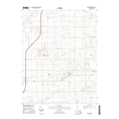
2016 Map of Montgomery
USGS Topo · Published 2016About this map
The town of Montgomery sits at the heart of this Daviess County landscape, reflecting the agricultural and water-management patterns of southwestern Indiana. This map details a region defined by an intricate network of waterways and drainage systems, including Bethel Ditch, Eagan Ditch, and Oberts Ditch, which support the surrounding farmland. The settlement of Cannelburg lies to the east, while Black Oak is situated to the west, connected by the corridor of Old Hwy 50.
Find a feature on this map
50 named features on this map. Tap any name to fly to it.
Don’t see what you’re looking for? This feature index may not catch every label — zoom into the map to look around manually.
Map Details
Editions of this 2016 Montgomery Map
This is the sole edition of this map. No revisions or reprints were ever made.
Other maps of this area

1943 · Plainville
USGS Topo · 1:24,000

1943 · Epsom
USGS Topo · 1:24,000

1944 · Montgomery
USGS Topo · 1:24,000

1944 · Glendale
USGS Topo · 1:24,000

1944 · Washington
USGS Topo · 1:24,000

1945 · Sandy Hook
USGS Topo · 1:24,000

1950 · Odon
USGS Topo · 1:24,000

1956 · Alfordsville
USGS Topo · 1:24,000

1956 · Loogootee
USGS Topo · 1:24,000

1956 · Vincennes
USGS Topo · 1:250,000