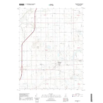
2019 Map of Montgomery
USGS Topo · Published 2019About this map
Montgomery and Cannelburg anchor this rural landscape in Daviess County, where small-town Indiana life is defined by a grid of agricultural county roads and a network of drainage ditches and creeks. This 2019 survey reflects the region’s long-standing reliance on its water systems, featuring engineered water management sites like Prairie Cr Structure Number B-2-1 and Prairie Cr Structure Number B-3-2. The landscape is etched with the courses of N Fork Prairie Cr and S Fork Prairie Cr, alongside family-named landmarks like Oberts Ditch and Eagan Ditch. Local genealogy is centered around sites such as Saint Peters Cem and Stoll Cem, which offer physical links to the area's early residents. The road network, including Old US Highway 50, shows the shift from historic transit corridors to modern regional connectivity near Black Oak.
Find a feature on this map
44 named features on this map. Tap any name to fly to it.
Don’t see what you’re looking for? This feature index may not catch every label — zoom into the map to look around manually.
Map Details
Editions of this 2019 Montgomery Map
This is the sole edition of this map. No revisions or reprints were ever made.
Other maps of this area

1943 · Plainville
USGS Topo · 1:24,000

1943 · Epsom
USGS Topo · 1:24,000

1944 · Montgomery
USGS Topo · 1:24,000

1944 · Glendale
USGS Topo · 1:24,000

1944 · Washington
USGS Topo · 1:24,000

1945 · Sandy Hook
USGS Topo · 1:24,000

1950 · Odon
USGS Topo · 1:24,000

1956 · Alfordsville
USGS Topo · 1:24,000

1956 · Loogootee
USGS Topo · 1:24,000

1956 · Vincennes
USGS Topo · 1:250,000