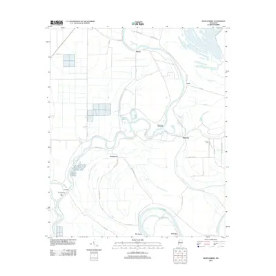
2012 Map of Montgomery
USGS Topo · Published 2012About this map
The Yazoo River defines the winding character of this Mississippi Delta landscape, where a complex system of oxbows and cut-offs reveals the water's historic shifts. Small settlements like Montgomery, Marksville, and Mayday are linked by a network of plantation roads, including Montgomery Plnt Rd and Baldwin Plantation Rd, reflecting the area's deep agricultural roots. The presence of Lennard Cem and the naming of features such as Dead Man Lake Rd offer tangible points of interest for those researching local family history or the evolution of rural land use. To the south, the dramatic bend of the river creates distinctive features like Horseshoe and Horseshoe Lake, while the Silent Shade Cut-Off indicates engineering efforts to manage the river's flow near the community of Silent Shade.
Find a feature on this map
51 named features on this map. Tap any name to fly to it.
Don’t see what you’re looking for? This feature index may not catch every label — zoom into the map to look around manually.
Map Details
Editions of this 2012 Montgomery Map
This is the sole edition of this map. No revisions or reprints were ever made.
Other maps of this area

1940 · Seven Pines
USGS Topo · 1:62,500

1940 · Lexington
USGS Topo · 1:62,500

1940 · Mileston
USGS Topo · 1:62,500

1953 · Greenwood
USGS Topo · 1:250,000

1954 · Mileston
USGS Topo · 1:62,500

1956 · Greenwood
USGS Topo · 1:250,000

1957 · Lexington
USGS Topo · 1:62,500

1957 · Seven Pines
USGS Topo · 1:62,500

1958 · Seven Pines
USGS Topo · 1:62,500

1958 · Lexington
USGS Topo · 1:62,500