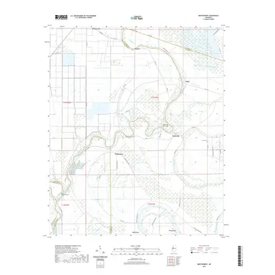
2020 Map of Montgomery
USGS Topo · Published 2020About this map
The Yazoo River defines the drainage of this Delta landscape, carving a winding path through the northern reaches near Mayday. The settlement pattern follows the high ground between the river and the expansive wetlands of the south, with small communities like Morgan City, Marksville, and Montgomery linked by a network of county roads. The terrain is marked by hydrological features typical of the region, including Eagle Brake and Tchula Lake, which reflect the historic shifting of river channels over time.
Find a feature on this map
51 named features on this map. Tap any name to fly to it.
Don’t see what you’re looking for? This feature index may not catch every label — zoom into the map to look around manually.
Map Details
Editions of this 2020 Montgomery Map
This is the sole edition of this map. No revisions or reprints were ever made.
Other maps of this area

1940 · Seven Pines
USGS Topo · 1:62,500

1940 · Lexington
USGS Topo · 1:62,500

1940 · Mileston
USGS Topo · 1:62,500

1953 · Greenwood
USGS Topo · 1:250,000

1954 · Mileston
USGS Topo · 1:62,500

1956 · Greenwood
USGS Topo · 1:250,000

1957 · Lexington
USGS Topo · 1:62,500

1957 · Seven Pines
USGS Topo · 1:62,500

1958 · Seven Pines
USGS Topo · 1:62,500

1958 · Lexington
USGS Topo · 1:62,500