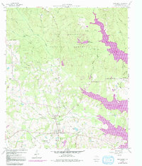
1959 Map of Montgomery
USGS Topo · Published 1991About this map
Montgomery serves as the focal point of this Montgomery County survey, which documents the landscape as it transitioned with the creation of Lake Conroe. The map illustrates a community anchored by several rural churches and educational sites, including China Chapel, Lincoln Sch, and Mt Pleasant Ch. An Old Railroad Grade north of Little Lake Creek provides a tangible link to former industrial transport lines, while more contemporary infrastructure like a Pipeline and several man-made lakes, such as Stanley Lake and Stewart Lake, indicate shifting land use in the mid-20th century.
Find a feature on this map
36 named features on this map. Tap any name to fly to it.
Don’t see what you’re looking for? This feature index may not catch every label — zoom into the map to look around manually.
Map Details
Editions of this 1959 Montgomery Map
4 editions found
Other maps of this area

1954 · Beaumont
USGS Topo · 1:250,000

1957 · Beaumont
USGS Topo · 1:250,000

1958 · Cowl Spur
USGS Topo · 1:24,000

1958 · Lake Paula
USGS Topo · 1:24,000

1959 · Moore Grove
USGS Topo · 1:24,000

1959 · San Jacinto
USGS Topo · 1:24,000

1959 · Montgomery
USGS Topo · 1:24,000

1962 · Keenan
USGS Topo · 1:24,000

1962 · Dacus
USGS Topo · 1:24,000

1962 · Plantersville
USGS Topo · 1:24,000