
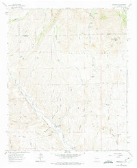
1961 Map of Monticello
USGS Topo · Published 1964About this map
The Alamosa River cuts through this high canyon country, providing a lifeline for the small agricultural settlements of Monticello and Placitas. In the early 1960s, the community at Monticello was centered around the St Ignatius Ch and the nearby Monticello Cem, with a Rodeo Ground serving as a local gathering point along the riverbanks. The landscape is defined by the sharp transition between the Cibola National Forest to the north and the intricate drainage systems of Monticello Canyon.
Find a feature on this map
65 named features on this map. Tap any name to fly to it.
Don’t see what you’re looking for? This feature index may not catch every label — zoom into the map to look around manually.
Map Details
Editions of this 1961 Monticello Map
2 editions found
Other maps of this area

1954 · Tularosa
USGS Topo · 1:250,000

1958 · Tularosa
USGS Topo · 1:250,000

1961 · Priest Tank
USGS Topo · 1:24,000

1961 · Huerfano Hill
USGS Topo · 1:24,000

1961 · Sierra Fijardo
USGS Topo · 1:24,000

1964 · Vicks Peak
USGS Topo · 1:24,000

1964 · Montoya Butte
USGS Topo · 1:24,000

1964 · Steel Hill
USGS Topo · 1:24,000

1965 · Jaralosa Mountain
USGS Topo · 1:24,000
1965 · Chise
USGS Topo · 1:24,000