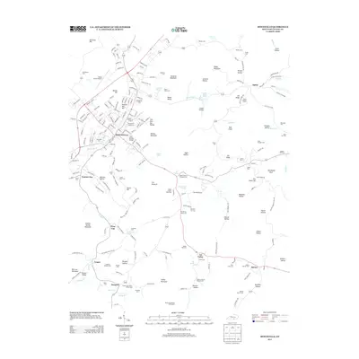
2013 Map of Monticello
USGS Topo · Published 2013About this map
Monticello serves as the central hub of this Wayne County landscape, where the urban street grid meets a countryside defined by deep hollows and prominent ridges. The geography is punctuated by significant landmarks like the Wayne County Speedway and the Wayne County Airport, while the Spann Lookout Tower stands sentinel over the eastern heights of Elk Ridge. This survey reveals a community deeply rooted in its local ancestry, as evidenced by the high density of small, family-named cemeteries such as the Benjamin F Coffey Cem and the Andrew Jackson Roberts Cem tucked away near Oil Valley. Settlement patterns follow the winding paths of Elk Spring Cr and Shiloh Cr, with smaller clusters appearing at Number One, Cooper, and Barrier. The terrain is characterized by distinctive formations like The Pinnacle and The Sand Cliff, which dominate the central and eastern portions of the quadrangle.
Find a feature on this map
215 named features on this map. Tap any name to fly to it.
Don’t see what you’re looking for? This feature index may not catch every label — zoom into the map to look around manually.
Map Details
Editions of this 2013 Monticello Map
This is the sole edition of this map. No revisions or reprints were ever made.
Other maps of this area

1911 · Monticello
USGS Topo · 1:62,500

1914 · Monticello
USGS Topo · 1:62,500

1932 · Burnside
USGS Topo · 1:62,500

1934 · Barthell
USGS Topo · 1:62,500

1934 · Pall Mall
USGS Topo · 1:62,500

1953 · Frazer
USGS Topo · 1:24,000

1953 · Parnell
USGS Topo · 1:24,000

1953 · Monticello
USGS Topo · 1:24,000

1953 · Mill Springs
USGS Topo · 1:24,000

1954 · Jabez
USGS Topo · 1:24,000