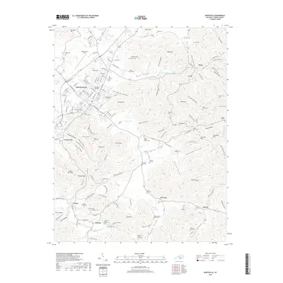
2019 Map of Monticello
USGS Topo · Published 2019About this map
Monticello serves as the regional hub for this part of Wayne County, sitting at the junction of complex terrain and early Kentucky settlement patterns. The landscape is defined by a dense network of hollows and ridges, such as Grannie Hollow and Elk Ridge, which dictate the placement of rural communities like Number One and Oil Valley. The map is particularly rich in genealogical data, preserving the locations of numerous family-specific burial grounds including the Andrew Jackson Roberts Cem, Crabtree Burgess Cem, and the Hardin and Martha Coffey Cem. Water sources are equally central to the local geography, with Elk Spring Cr and distinctive features like Four Neck Pond and Doublehead Spring providing landmarks across the varied elevations. The presence of the Wayne County Airport and the concentrated street grid of the county seat contrast with the dispersed homesteads found along Sumpter Br and near The Round Rock.
Find a feature on this map
174 named features on this map. Tap any name to fly to it.
Don’t see what you’re looking for? This feature index may not catch every label — zoom into the map to look around manually.
Map Details
Editions of this 2019 Monticello Map
This is the sole edition of this map. No revisions or reprints were ever made.
Other maps of this area

1911 · Monticello
USGS Topo · 1:62,500

1914 · Monticello
USGS Topo · 1:62,500

1932 · Burnside
USGS Topo · 1:62,500

1934 · Barthell
USGS Topo · 1:62,500

1934 · Pall Mall
USGS Topo · 1:62,500

1953 · Frazer
USGS Topo · 1:24,000

1953 · Parnell
USGS Topo · 1:24,000

1953 · Monticello
USGS Topo · 1:24,000

1953 · Mill Springs
USGS Topo · 1:24,000

1954 · Jabez
USGS Topo · 1:24,000