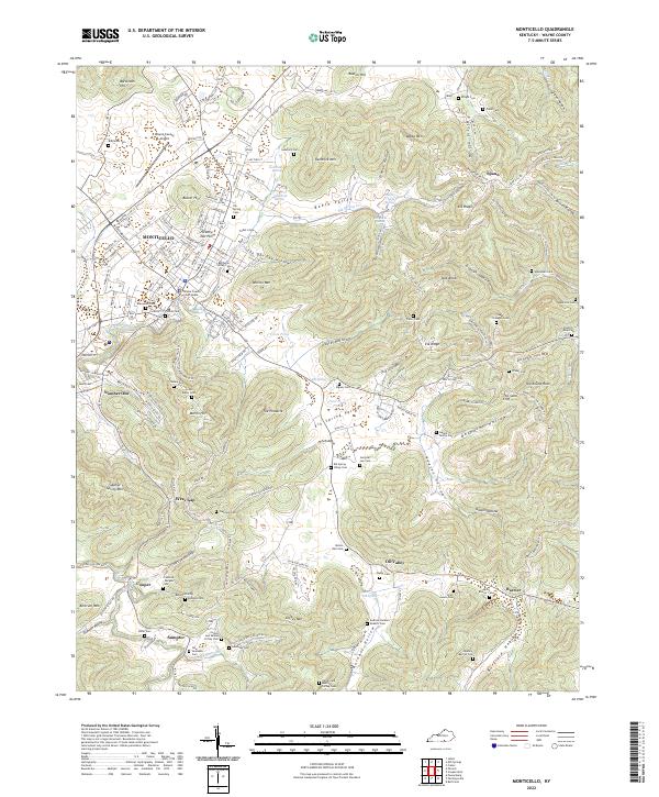
2022 Map of Monticello
USGS Topo · Published 2022About this map
Monticello and its surrounding Wayne County landscape are defined by a complex network of ridges and hollows that have long shaped the region's movement and settlement patterns. The map documents numerous family burial grounds and historical cemeteries, such as the Hardin and Martha Coffey Cem and the Dabney Barrier Cem, which offer significant value for genealogical research in this part of Kentucky. The terrain is marked by distinctive natural features including The Pinnacle and The Round Rock, while the town center remains anchored by the Wayne County Court House.
Find a feature on this map
90 named features on this map. Tap any name to fly to it.
Don’t see what you’re looking for? This feature index may not catch every label — zoom into the map to look around manually.
Map Details
Editions of this 2022 Monticello Map
This is the sole edition of this map. No revisions or reprints were ever made.
Historical Maps of Number One Through Time
5 maps found