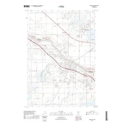
2019 Map of Monticello
USGS Topo · Published 2019About this map
The Mississippi River carves a diagonal path through this 2019 survey, serving as the natural boundary between Sherburne and Wright counties. On the southern bank, the city of Monticello anchors the landscape, characterized by a dense network of residential streets and community landmarks such as Hillside Cem and Saint Henrys Cem. North of the river, the settlement of Becker and the community surrounding Big Lake demonstrate the region's late-20th and early-21st-century suburban and recreational growth.
Find a feature on this map
120 named features on this map. Tap any name to fly to it.
Don’t see what you’re looking for? This feature index may not catch every label — zoom into the map to look around manually.
Map Details
Editions of this 2019 Monticello Map
This is the sole edition of this map. No revisions or reprints were ever made.
Other maps of this area

1909 · Rockford
USGS Topo · 1:62,500

1953 · Stillwater
USGS Topo · 1:250,000

1955 · Stillwater
USGS Topo · 1:250,000

1958 · Stillwater
USGS Topo · 1:250,000

1958 · Rockford
USGS Topo · 1:62,500

1958 · Buffalo
USGS Topo · 1:62,500

1961 · Clear Lake
USGS Topo · 1:24,000

1961 · Big Lake
USGS Topo · 1:24,000

1961 · Silver Creek
USGS Topo · 1:24,000

1961 · Orrock
USGS Topo · 1:24,000