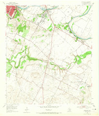
1955 Map of Montopolis
USGS Topo · Published 1965About this map
The Colorado River meanders along the northern edge of this mid-1950s survey, marking the boundary where the growing city of Austin meets the rural landscapes of southern Travis County. The settlement of Montopolis serves as a gateway to the region, characterized by a transition from industrial activity like the Austin Sewage Disposal and various Gravel Pits to the agricultural reaches of Del Valle and Colton. The landscape is defined by the significant topographic rise of Pilot Knob and the winding course of Onion Creek, which creates a natural corridor through the southern portion of the quadrangle.
Find a feature on this map
35 named features on this map. Tap any name to fly to it.
Don’t see what you’re looking for? This feature index may not catch every label — zoom into the map to look around manually.
Map Details
Editions of this 1955 Montopolis Map
2 editions found
Other maps of this area

1896 · Austin
USGS Topo · 1:125,000

1897 · Austin
USGS Topo · 1:125,000

1910 · Austin
USGS Topo · 1:125,000

1932 · Mt. Bonnell
USGS Topo · 1:62,500

1954 · Austin East
USGS Topo · 1:24,000

1954 · Austin West
USGS Topo · 1:24,000

1954 · Austin
USGS Topo · 1:250,000

1955 · Montopolis
USGS Topo · 1:24,000

1955 · Oak Hill
USGS Topo · 1:24,000

1955 · Montopolis
USGS Topo · 1:62,500