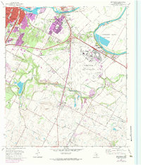
1973 Map of Montopolis
USGS Topo · Published 1984About this map
Bergstrom Air Force Base dominates the center of this landscape, its runways and military facilities sprawling south of the Colorado River. This mid-century view captures the transition of the outskirts of Austin from rural to suburban, with significant expansion noted around Montopolis and the riverside Fiesta Gardens. The river itself defines the northern reaches, winding past Hornsby Bend and the Montopolis Bridge, while the southern half of the map retains a more agrarian character punctuated by local landmarks like the Pilot Knob volcanic formation.
Find a feature on this map
50 named features on this map. Tap any name to fly to it.
Don’t see what you’re looking for? This feature index may not catch every label — zoom into the map to look around manually.
Map Details
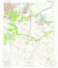
Editions of this 1973 Montopolis Map
2 editions found
Other maps of this area

1896 · Austin
USGS Topo · 1:125,000

1897 · Austin
USGS Topo · 1:125,000

1910 · Austin
USGS Topo · 1:125,000

1932 · Mt. Bonnell
USGS Topo · 1:62,500

1954 · Austin East
USGS Topo · 1:24,000

1954 · Austin West
USGS Topo · 1:24,000

1954 · Austin
USGS Topo · 1:250,000

1955 · Montopolis
USGS Topo · 1:24,000

1955 · Oak Hill
USGS Topo · 1:24,000

1955 · Montopolis
USGS Topo · 1:62,500