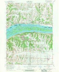
1953 Map of Montpelier
USGS Topo · Published 1971About this map
The Mississippi River creates a significant geographical and political boundary here, separating Muscatine and Scott counties in Iowa from Rock Island County in Illinois. Along the northern bank, the Chicago Rock Island and Pacific railroad parallels the water, connecting small riverside hubs like Montpelier and Midway Beach. The river itself is dominated by the Upper Mississippi River Wild Life and Fish Refuge, which includes complex water features like Velie Chute and the extensive Andalusia Slough.
Find a feature on this map
40 named features on this map. Tap any name to fly to it.
Don’t see what you’re looking for? This feature index may not catch every label — zoom into the map to look around manually.
Map Details
Editions of this 1953 Montpelier Map
3 editions found
Other maps of this area

1890 · Durant
USGS Topo · 1:62,500

1891 · Davenport
USGS Topo · 1:62,500

1894 · Durant
USGS Topo · 1:62,500

1894 · Davenport
USGS Topo · 1:62,500

1901 · Rock Island
USGS Topo · 1:125,000

1910 · Rock Island
USGS Topo · 1:125,000

1912 · Milan
USGS Topo · 1:62,500

1916 · Edgington
USGS Topo · 1:62,500

1938 · Edgington
USGS Topo · 1:62,500

1944 · Milan
USGS Topo · 1:62,500