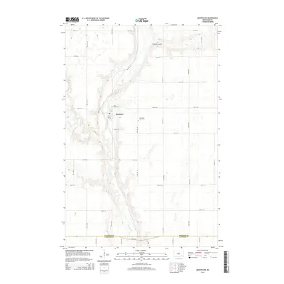
2014 Map of Montpelier
USGS Topo · Published 2014About this map
Montpelier serves as the primary settlement on this North Dakota prairie, situated along the winding course of the James River. The town's grid, featuring Main St, 1st St, and 2nd St, sits just south of the Saint Huberts Cem, while the James River Valley Cem overlooks the river valley to the east. The landscape is defined by the gradual drainage of the James River and its tributaries, including Beaver Cr and Streaman Coulee, which cut through the surrounding agricultural sections.
Find a feature on this map
29 named features on this map. Tap any name to fly to it.
Don’t see what you’re looking for? This feature index may not catch every label — zoom into the map to look around manually.
Map Details
Editions of this 2014 Montpelier Map
This is the sole edition of this map. No revisions or reprints were ever made.
Other maps of this area

1896 · Jamestown
USGS Topo · 1:125,000

1897 · Eckelson
USGS Topo · 1:125,000

1952 · Homer
USGS Topo · 1:24,000

1952 · Ypsilanti
USGS Topo · 1:24,000

1952 · Dickey
USGS Topo · 1:24,000

1953 · Jamestown
USGS Topo · 1:250,000

1953 · Montpelier
USGS Topo · 1:24,000

1953 · Montpelier NW
USGS Topo · 1:24,000

1953 · Adrian
USGS Topo · 1:24,000

1953 · Nortonville
USGS Topo · 1:24,000