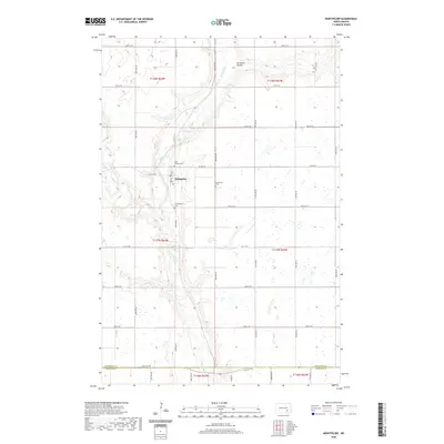
2020 Map of Montpelier
USGS Topo · Published 2020About this map
Montpelier stands as a focal point in this portion of the Dakota prairie, situated where Main St and 1st St provide a small-town grid near the winding James River. The landscape is defined by the intersection of water and faith, with three distinct burial sites — Saint Huberts Cem, Montpelier Cem, and Presbyterian Cem — serving as significant markers for family historians. The surrounding terrain is carved by natural drainages like Beaver Cr and Streaman Coulee, which disrupt the otherwise orderly township and range grid. This geography illustrates a late-twentieth-century rural environment where local infrastructure remains closely tied to the original section-line roads, such as Co Hwy 63 and 49th St SE, even as the community maintains its identity on the border of Stutsman and LaMoure counties.
Find a feature on this map
33 named features on this map. Tap any name to fly to it.
Don’t see what you’re looking for? This feature index may not catch every label — zoom into the map to look around manually.
Map Details
Editions of this 2020 Montpelier Map
This is the sole edition of this map. No revisions or reprints were ever made.
Other maps of this area

1896 · Jamestown
USGS Topo · 1:125,000

1897 · Eckelson
USGS Topo · 1:125,000

1952 · Homer
USGS Topo · 1:24,000

1952 · Ypsilanti
USGS Topo · 1:24,000

1952 · Dickey
USGS Topo · 1:24,000

1953 · Jamestown
USGS Topo · 1:250,000

1953 · Montpelier
USGS Topo · 1:24,000

1953 · Montpelier NW
USGS Topo · 1:24,000

1953 · Adrian
USGS Topo · 1:24,000

1953 · Nortonville
USGS Topo · 1:24,000