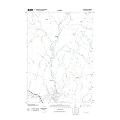
2012 Map of Montpelier
USGS Topo · Published 2012About this map
The Winooski River and its branches define the landscape of the Vermont state capital and surrounding Washington County hills in this 2012 survey. The confluence of the main river and the Dog River near Montpelier Junction highlights the importance of the valley floor for transportation, specifically for the Central Vermont RR. North of the city, the Wrightsville Reservoir and its associated Wrightsville Beach Recreation Area show the modernization of water management along the North Branch, while smaller settlements like Adamant and Putnamville maintain their rural character.
Find a feature on this map
146 named features on this map. Tap any name to fly to it.
Don’t see what you’re looking for? This feature index may not catch every label — zoom into the map to look around manually.
Map Details
Editions of this 2012 Montpelier Map
This is the sole edition of this map. No revisions or reprints were ever made.
Other maps of this area

1919 · Montpelier
USGS Topo · 1:62,500

1921 · Montpelier
USGS Topo · 1:62,500

1922 · Barre
USGS Topo · 1:48,000

1924 · Barre
USGS Topo · 1:62,500

1939 · Plainfield
USGS Topo · 1:48,000

1940 · Plainfield
USGS Topo · 1:62,500

1943 · Plainfield
USGS Topo · 1:62,500

1944 · Montpelier
USGS Topo · 1:62,500

1947 · Corinth
USGS Topo · 1:62,500

1948 · East Barre
USGS Topo · 1:62,500