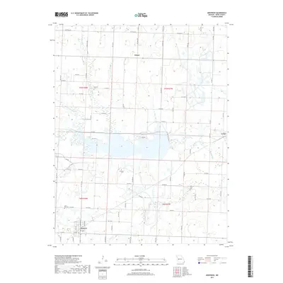
2017 Map of Montrose
USGS Topo · Published 2017About this map
Montrose anchors the southwestern corner of this West-Central Missouri landscape, where a dense grid of rural roads connects established family farms and small crossroad communities. The area is defined by its numerous small drainage systems, including Deepwater Cr, Bear Cr, and Granddaddy Cr, which carve gentle valleys through the Henry County countryside. Genealogists will find several notable local burial grounds preserved here, such as Saint Mary Cem just outside Montrose, Vickers Cem near the center of the quadrangle, and Bear Creek Cem to the east. These sites, along with the small settlements of Delmar and La Due, represent the historical persistence of rural townships in a region largely dedicated to agriculture and livestock. The map also traces the winding courses of Willow Br and Fishing Cr as they feed into larger tributaries, illustrating the local water network that has influenced property lines and road placements for generations.
Find a feature on this map
68 named features on this map. Tap any name to fly to it.
Don’t see what you’re looking for? This feature index may not catch every label — zoom into the map to look around manually.
Map Details
Editions of this 2017 Montrose Map
This is the sole edition of this map. No revisions or reprints were ever made.
Other maps of this area

1887 · Clinton
USGS Topo · 1:125,000

1887 · Butler
USGS Topo · 1:125,000

1894 · Butler
USGS Topo · 1:125,000

1894 · Clinton
USGS Topo · 1:125,000

1947 · Jefferson City
USGS Topo · 1:250,000

1947 · Lawrence
USGS Topo · 1:250,000

1950 · Lawrence
USGS Topo · 1:250,000

1953 · Johnstown
USGS Topo · 1:24,000

1953 · Montrose
USGS Topo · 1:24,000

1953 · Hartwell
USGS Topo · 1:24,000