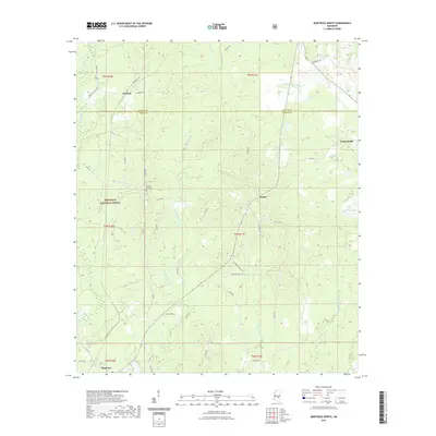
2021 Map of Montrose North
USGS Topo · Published 2021About this map
Bienville National Forest dominates the western landscape of this central Mississippi region, where the border of Newton and Jasper counties cuts through a network of creeks and small crossroads settlements. Small communities like Roberts, Baxter, and Garlandville are connected by a web of rural roads, including State Hwy 505 and Boutwell Rd, reflecting a landscape defined by forestry and small-scale agriculture. The southern edge of the map features the town of Montrose, positioned near the headwaters of the winding Tallahoma Cr.
Find a feature on this map
47 named features on this map. Tap any name to fly to it.
Don’t see what you’re looking for? This feature index may not catch every label — zoom into the map to look around manually.
Map Details
Editions of this 2021 Montrose North Map
This is the sole edition of this map. No revisions or reprints were ever made.
Other maps of this area

1921 · Forest
USGS Topo · 1:48,000

1922 · Forest
USGS Topo · 1:62,500

1950 · Forest
USGS Topo · 1:62,500

1952 · Forest
USGS Topo · 1:62,500

1953 · Meridian
USGS Topo · 1:250,000

1957 · Meridian
USGS Topo · 1:250,000

1965 · Meridian
USGS Topo · 1:250,000

1966 · Hickory
USGS Topo · 1:24,000

1966 · Newton
USGS Topo · 1:24,000

1968 · Clear Springs
USGS Topo · 1:24,000