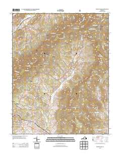
2013 Map of Montvale
USGS Topo · Published 2013About this map
Montvale serves as a primary settlement node in this 2013 survey, situated where the Blue Ridge Pkwy begins its winding ascent through the ridges of Bedford County. The terrain is defined by a series of prominent overlooks and gaps, including Harveys Knob and Bearwallow Gap, which offer vantage points over the surrounding valleys. The water network is dominated by the N Fork Goose Cr and its various tributaries like Hemp Mill Br and Sheep Cr, which carve through the land between Taylors Mountain and Cove Mountain.
Find a feature on this map
119 named features on this map. Tap any name to fly to it.
Don’t see what you’re looking for? This feature index may not catch every label — zoom into the map to look around manually.
Map Details
Editions of this 2013 Montvale Map
This is the sole edition of this map. No revisions or reprints were ever made.
Other maps of this area

1890 · Roanoke
USGS Topo · 1:125,000

1891 · Roanoke
USGS Topo · 1:125,000

1894 · Natural Bridge
USGS Topo · 1:125,000

1894 · Natural Bridge
USGS Topo · 1:62,500

1907 · Natural Bridge Special
USGS Topo · 1:62,500

1913 · Eagle Rock
USGS Topo · 1:48,000

1915 · Eagle Rock
USGS Topo · 1:62,500

1929 · Roanoke
USGS Topo · 1:48,000

1933 · Roanoke
USGS Topo · 1:62,500

1947 · Roanoke
USGS Topo · 1:250,000