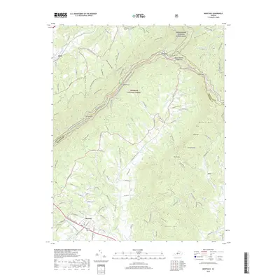
2019 Map of Montvale
USGS Topo · Published 2019About this map
The community of Montvale and the surrounding peaks of the Jefferson National Forest characterize this part of the Blue Ridge Mountains at the border of Botetourt and Bedford Counties. The landscape is defined by its deep gaps and prominent ridges, including McFalls Mtn, Taylors Mtn, and Campbells Mtn. Transportation corridors follow the natural topography, with the Blue Ridge Pkwy winding along the high ground near Harveys Knob and Bearwallow Gap.
Find a feature on this map
116 named features on this map. Tap any name to fly to it.
Don’t see what you’re looking for? This feature index may not catch every label — zoom into the map to look around manually.
Map Details
Editions of this 2019 Montvale Map
This is the sole edition of this map. No revisions or reprints were ever made.
Other maps of this area

1890 · Roanoke
USGS Topo · 1:125,000

1891 · Roanoke
USGS Topo · 1:125,000

1894 · Natural Bridge
USGS Topo · 1:125,000

1894 · Natural Bridge
USGS Topo · 1:62,500

1907 · Natural Bridge Special
USGS Topo · 1:62,500

1913 · Eagle Rock
USGS Topo · 1:48,000

1915 · Eagle Rock
USGS Topo · 1:62,500

1929 · Roanoke
USGS Topo · 1:48,000

1933 · Roanoke
USGS Topo · 1:62,500

1947 · Roanoke
USGS Topo · 1:250,000