
1939 Map of Montville
USGS Topo · Published 1939About this map
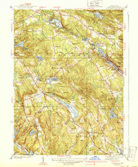
Oxoboxo Lake and the various reservoirs of the Montville and Waterford hills reveal a landscape shaped by water and industry in the years preceding World War II. The network of smaller water bodies such as Wheeler Pond, Rockland Pond, and Schofield Pond supported local milling and power needs along the brooks that feed the larger Thames River system. Settlement centers like Oakdale and Montville Center appear alongside numerous rural schools, including the West Side Sch and Collins Sch, which anchored the upland neighborhoods before modern consolidation.
Find a feature on this map
86 named features on this map. Tap any name to fly to it.
Don’t see what you’re looking for? This feature index may not catch every label — zoom into the map to look around manually.
Map Details
Editions of this 1939 Montville Map
3 editions found
Other maps of this area

1892 · New London
USGS Topo · 1:62,500

1892 · Norwich
USGS Topo · 1:62,500

1892 · Gilead
USGS Topo · 1:62,500

1893 · New London
USGS Topo · 1:62,500

1893 · Saybrook
USGS Topo · 1:62,500

1921 · New London
USGS Topo · 1:62,500

1934 · Niantic
USGS Topo · 1:24,000

1935 · Montville
USGS Topo · 1:24,000

1938 · New London
USGS Topo · 1:31,680

1938 · Niantic
USGS Topo · 1:62,500