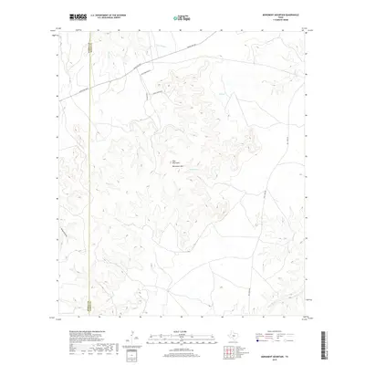
2019 Map of Monument Mountain
USGS Topo · Published 2019About this map
The Blue Mountains dominate this section of the Texas Hill Country, where high plateaus and deep drainage draws define the land use and ranching patterns. Along the northern edge, Ranch Rd 1871 provides the primary access route across the rugged terrain, crossing several ephemeral waterways including Little Rocky Cr and Rocky Cr. The namesake Monument Mtn sits as a central landmark, part of a complex ridgeline that separates the northern creek systems from the James River basin to the southeast. Local infrastructure is largely shaped by the topography, with Mill Creek Rd and Ernest Jordan Rd following the contours of the valleys. Isolated water sources like Walnut Spring and the expansive Edwards Draw indicate the vital importance of water management in this arid environment along the border of Kimble Co and Mason Co.
Find a feature on this map
14 named features on this map. Tap any name to fly to it.
Don’t see what you’re looking for? This feature index may not catch every label — zoom into the map to look around manually.
Map Details
Editions of this 2019 Monument Mountain Map
This is the sole edition of this map. No revisions or reprints were ever made.
Other maps of this area

1887 · Mason
USGS Topo · 1:125,000

1894 · Mason
USGS Topo · 1:125,000

1894 · Kerrville
USGS Topo · 1:125,000

1954 · Llano
USGS Topo · 1:250,000

1955 · Llano
USGS Topo · 1:250,000

1956 · Llano
USGS Topo · 1:250,000
1967 · Monument Mountain SE
USGS Topo · 1:24,000

1968 · Monument Mountain
USGS Topo · 1:24,000
1968 · Turtle Creek
USGS Topo · 1:24,000

1968 · Sheep Run Creek
USGS Topo · 1:24,000